ErdaGISweb system services
Basemap: It is possible to load DAT data exchange, dwg, dxf, dgn formats to the base map.
By pointing to any part of land, the message section will display the parcel number, character, address,
area.
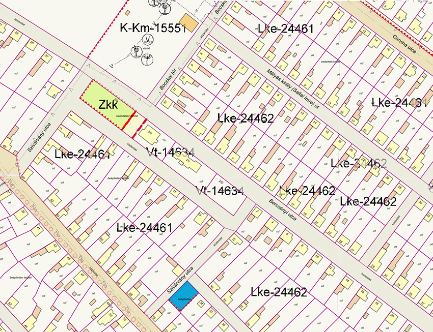
Zoning plan: The zoning and regulatory plans can also be loaded into the ErdaDIS web system as,
so that building regulations can be queried. A printable version of the queried land parcel
building regulations, overviews and detailed site plans can be displayed in a printable form.
Land book Available free of charge to local authorities, land register
to the land parcels. In the system, any detail of the land register can be searched for
system displays the results in a pop-up window and sub-displays them in the map window.
Population register: If the municipality has population register data, excel
table containing the parcel numbers, they can also be loaded into the system. After that
can be easily queried by name or even by a selected parcel of land. By name
search by name, e.g. Tóth, the results are listed and displayed on the map. In the list, a selected
person
the system will click on the relevant parcel of land on the map.
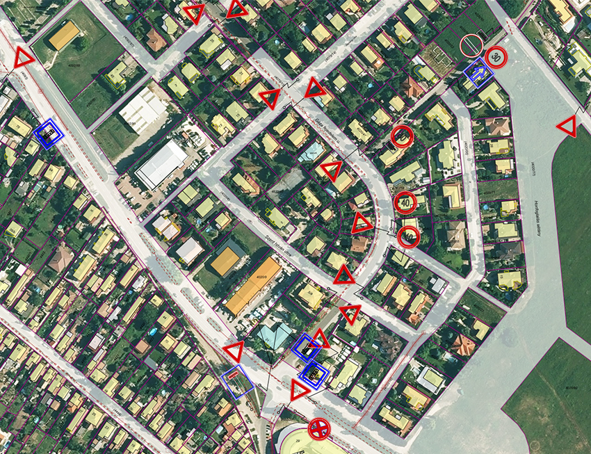
Traffic signs: It is possible to install traffic signs, pavement markings and maintenance
and maintenance data. The corresponding upload system is a proprietary development of our own
Bentley platform.